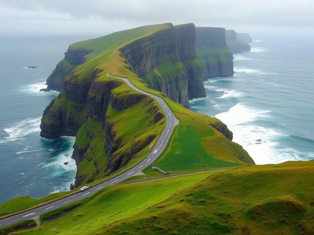
Wild Atlantic Way, Ireland
All road trips

West coast of Ireland

Wild Atlantic Way

Ireland's Atlantic coast, Donegal to Cork

10 days~1,500 kmCalculating… drivingDonegal Town → Cork

Donegal to Cork with the whole west coast at a workable pace.

About this route

The full Wild Atlantic Way is roughly 2,500 km of signed coastal road — far more than most trips can absorb. This template treats it honestly: a 10-day highlights run from Donegal to Cork, a 7-day version that starts in Galway and skips the north-west, and a 14-day version that does the whole seaboard at a civilised pace. Roads are narrow and slow; the itinerary is built around that rather than pretending otherwise.

Coastal drivingCliffsBeachesMusic and pubsSmall villages

Day by day

Start at Ireland's highest accessible sea cliffs, then south along the Donegal Bay coast.

Roads: R263 · N15

Where to stay

Sligo

Roadly suggestions

Sligo hotels

hotel · comfort

Campervan & Motorhome Stops

Find campsites, motorhome areas, overnight stops and useful services near Sligo.

Park4Night can help you discover campsites, motorhome areas, parking and stopping places, water, waste services, laundry and other traveller services.

Opens an external service

Park4Night is an external service. Always check current local signs, site rules and overnight restrictions before staying.

  • The upper Slieve League car park is reached by a narrow road with a gate.

Weather on this route

Weather is changeable all year; plan flexible days rather than fixed viewpoints. Dates beyond the 16-day forecast window show a seasonal outlook.

Weather along the way

Checking the forecast for your dates…

Approximate costs

Indicative totals for 10 days, 2 adults. Fuel is based on the live route distance.

Budget

€800–€1,650

  • Accommodation€360–€700
  • Food & drink€300–€500
  • Attractions & activities€0–€200
  • Fuel€160–€230
  • Tolls€0–€15
  • Ferries€0–€40

Comfort

€1,950–€3,350

  • Accommodation€1,000–€1,600
  • Food & drink€600–€1,000
  • Attractions & activities€200–€450
  • Fuel€160–€230
  • Tolls€0–€15
  • Ferries€0–€40

Premium

€3,800–€6,600

  • Accommodation€2,000–€3,400
  • Food & drink€1,200–€2,000
  • Attractions & activities€450–€900
  • Fuel€160–€230
  • Tolls€0–€15
  • Ferries€0–€40
  • The M50 around Dublin is tolled if you arrive that way; the west coast route itself is largely toll-free.
  • Optional short ferries (for example the Shannon Estuary crossing) can save significant driving.
  • Estimates only — Roadly never quotes live prices.

Who this route suits

Families

good

Friendly and easy-going, with plenty of beaches — but long, twisty driving days.

  • · Beaches at Keem, Mullaghmore and Inch are excellent for children.
  • · Kylemore Abbey and Killarney National Park suit all ages.
  • · Cliff edges at Slieve League and Moher are unfenced in places — supervise closely.

Campervans

good

A popular campervan route with good coverage of small, friendly campsites.

  • · Campsites throughout Donegal, Mayo, Galway, Clare, Kerry and West Cork.
  • · Some coastal loops have width restrictions and are signposted one-way in summer.
  • · Overnight parking at scenic car parks is often prohibited — use campsites.

Motorhomes

moderate

Fine on the main route; several peninsula loops are tight for long vehicles.

  • · Slea Head Drive is narrow with blind bends — check current restrictions for your length.
  • · Ring of Kerry is signed anti-clockwise for coaches; follow the same direction.
  • · Service points are available at most commercial campsites.

Electric vehicles

Ireland's charging network covers the main towns on this route well, with gaps on the remoter peninsulas. Roadly EV mode will produce charge-aware daily plans once your vehicle is set.

  • · Mostly toll-free; the Limerick tunnel and Dublin M50 are the exceptions.
  • · The Tarbert–Killimer ferry has a per-vehicle fare — check the current price with the operator.

Practical travel notes

Driving side
Left. Distances and speed limits are in kilometres.
Currency
Euro (EUR) in the Republic of Ireland.
Road type
Good national roads between towns, but the coastal loops are narrow, twisting and often unmarked. Average speeds are low.
Tolls
Few on this route; the Dublin M50 and Limerick tunnel are the main ones.
Ferries
The Tarbert–Killimer Shannon ferry is a useful shortcut between Clare and Kerry — check current sailings.
Fuel
Plentiful in towns; plan ahead on peninsulas like Slea Head and Mizen.
Campervans
Well served by campsites, but Slea Head and parts of the Ring of Kerry have width and one-way restrictions in summer.
Mobile signal
Generally good; patchy on remote peninsulas and in Connemara.

Roadly tips

  • · Drive the Slea Head loop clockwise, as the signage and coach traffic assume.
  • · Visit the Cliffs of Moher early or late — mid-day is the busiest.
  • · Book Dingle and Kenmare accommodation early in July and August.
  • · Take the Shannon ferry rather than driving around through Limerick.
  • · Leave room for weather: a wet morning is often a clear afternoon here.
Loading map…

Highlights

Best time to go

J
F
M
A
M
J
J
A
S
O
N
D
bestgoodpossiblechallenging
  • Weather is changeable all year; plan flexible days rather than fixed viewpoints.
  • Some island ferries and visitor centres operate seasonally — check current timetables.
  • The Slea Head and Ring of Kerry roads are busiest with coaches mid-morning in summer.